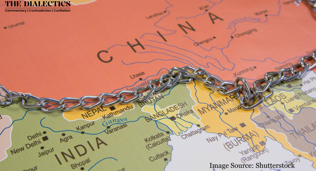
The Himalayas stand as the formidable natural barrier separating the Tibetan plateau and the Indian subcontinent and are increasingly seen as the playground for brewing tensions in the region comprising India, China, Pakistan, Nepal and Bhutan. Territorial claims, water disputes, historical differences, and military strategies heavily influence the Himalayan region’s geopolitics. Recent events of disagreements on the Indus water treaty, the building of infrastructure along the borders, military clashes, and the construction of dams pose a significant question of what makes the Himalayan region central to geopolitics in South Asia and evolves the strategies of each state in the area to remain secure in a situation of conflict.
India has a vast stretch of Himalayan ranges, including the Shiwalik, Lesser Himalayas, Greater Himalayas, and Purvanchal, coming in contact with 11 states and two union territories, making it a country which has to exercise influence over the region for strategic gains. Since India’s independence in 1947, the territorial claims regarding this region have continued because of how the borders are demarcated. Until the Akhnoor district, the international boundary has been accepted, but border claims continue to exist towards the north of it. The Pakistan-occupied Kashmir (POK) and Aksai Chin borders are highly vulnerable to trespassing and military aggression. The Siachen glacier that was redeemed in the operation of Megdhoot by the Indian army and air force in 1984, although seen as an ‘uninhabited piece of high altitude,’ proved of strategic importance for the military deployment to counter the presence of Pakistan and allowed for strategic significance for the Karakoram Pass and the Saltoro Ridge. Major rivers of Ganges, Indus, and Brahmaputra have their origin in the Himalayan region, making it pivotal for India to oversee any other influence, such as the Indus water treaty with Pakistan to the recent possibility of building dams on the Brahmaputra River by China, which may create a water bomb effect on the Northeast region. The increased border disputes along the Himalayan range in Ladakh, especially since the Galwan Valley incident, have created tensions between India and China. The claim of Arunachal Pradesh as China’s extension of the southern part of Tibet fuels more tensions in the region. For India, it becomes of immense strategic importance to keep countering any other state’s influence if it wants to become the undisputed regional player of South Asia.
The Western Himalayas
In the northwestern region of Pakistan and the Gilgit–Baltistan region, the Himalayan ranges, notably the Karakoram and Pir Panjal ranges, are pivotal in securing strategic importance for the state. The Karakoram Highway was built by China and Pakistan, based on shared interests, helping trade by connecting China’s Xinjiang Uyghur province and Pakistan’s Gilgit-Baltistan. The China-Pakistan Economic Corridor (CPEC), a flagship project under China’s Belt and Road Initiative (BRI), depends on the highway to advance strategic regional integration. CPEC seeks to enhance connectivity and infrastructure, with the Karakoram highway acting as a vital conduit for moving energy resources and goods. Although the upstream side of the Indus lies in India with limitations on the use of water, the downstream of the Indus within Pakistan has no such limitations, meaning that there are multiple opportunities for Pakistan to engage in agreements, as seen in 2017 with an estimated hydropower generation capacity of more than 22,000 MW as China has committed to a group of projects on the transboundary River Indus. The POK dispute with India and territorial claims continues to be an issue in the region.
The Eastern Himalayas
The state of China claims the territories of Aksai Chin and Arunachal Pradesh as part of Xinjiang and southern Tibet, respectively. These historical claims start from the Aksai Chin from the west and end with the inclusion of Indian-administered Arunachal Pradesh while including multiple other border disputes in Ladakh and Sikkim. On the western side of the Tibet autonomous region, it shares territorial claims in the Dhoklam region between China and Bhutan. Though the Himalayas act as a natural frontier to India’s North, China’s strategies continue influencing the region’s geopolitics. The Belt and Road Initiative by China to integrate the region while providing economic assistance and infrastructural development helps in its image as a trusted partner with its ally Pakistan and aids in the trade and building of ports that align with the more extensive interests of China to emerge as a global power.
As the Chinese understand, rivers are the highest possible weapons to dominate the region because the Himalayan glaciers feed the rivers in India, Nepal and Bhutan. Building dams on any of these rivers might cause floods or droughts, such as building a dam on the Brahmaputra River before entering Arunachal Pradesh in India. Many scholars suggest the possibility of China applying the strategic heartland theory, which is based on gaining control of Eurasia’s “Heartland,” including the Himalayas, which will lead to it becoming a global superpower as the heartland comprises massive economies, natural resources and population. Currently, dominance over the Himalayas seems to be the first step of China through the politico-economic infrastructures of CPEC and BRI. To counter that, the Rimland theory is gaining prominence among the states at the heartland’s edge, which align themselves against China’s rising power through forging relations between the Indian and Pacific Oceans, supported by many East Asian states, the US, and the EU. India is a key player in countering this power imbalance since it’s the closest neighbour to China.
Nepal and Bhutan
Nepal and Bhutan act as buffer states because of their geostrategic location between India and China. The recent tilt of Nepal towards China can be attributed to the multiple reasons of Foreign Direct Investment, infrastructure building as a part of the Belt Road Initiative, dry ports establishment along the Nepal-China border, and Hydroelectric project by China. However, Nepal continues its historical friendship agreement and treaty of 1950 with India for cordial relations.
The kingdom of Bhutan has the advantage of driving the geopolitics in the region because of the Doklam plateau and China’s aggressive behaviour towards its borders. The Doklam plateau, bordered by Bhutan, China, and India, lies adjacent to India’s Siliguri Corridor, connecting it to the Northeast and Chinese military bases posing threats to Bhutan and India, leading to Bhutan’s dependency on India for security and prioritising ties with India. Therefore, the Himalayan region assumes paramount importance for the nations of this region to maintain regional power equilibrium. The border disputes with Bhutan in the Dhoklam region prove a point of advantage to China, which can overlook the Siliguri corridor in India. China’s increasingly and slowly paced territorial claims are also reminiscent of the salami-slicing strategy, which allows for small, piece-by-piece influence over territories, thus culminating in complete annexation.